Find the Best Land Surveyors Near You
- Post a job
- Receive multiple quotes
- Choose your preferred Land Surveyor
Where do you need Land Surveyors?
Describe your job and our suppliers will send you quotes
Popular Land Surveyors Locations
Hundreds of Qualified Land Surveyors on iseekplant
iseekplant comprises an expansive network of over 190 professional land surveyors situated throughout Australia. Our accomplished surveyors can meet the diverse requirements of construction or development projects of any scale. Whether the objective is to initiate a large-scale industrial development or a small-scale residential renovation, our experienced surveyors are equipped to provide precise measurements and vital data to ensure that the foundation of your project is established on a bedrock of accuracy.
Land Surveying Rates Guide
Understanding the financial aspects of land surveying is crucial for project planning and budgeting. Below, we detail the typical hourly rates and projected costs for various types of land surveying services:
| Service Type | Average Cost per Hour | Typical Project Cost |
|---|---|---|
| Residential Land Survey | $100 - $150 | $500 - $2,500 |
| Commercial Land Survey | $150 - $300 | $2,000 - $10,000 |
| Topographic Land Survey | $120 - $200 | $1,500 - $5,000 |
Note: Rates are indicative and can vary based on project scope, location, and specific survey requirements. All prices are exclusive of GST.
Essential Tools and Technology Used by Land Surveyors
Land surveyors use an array of sophisticated survey equipment tools and technologies to ensure the highest levels of accuracy and efficiency. These advanced instruments enable surveyors to perform their tasks with unprecedented speed and precision, adapting to the evolving demands of complex projects and diverse environments:
- GPS (Global Positioning System): GPS technology is crucial in modern land surveying. It provides pinpoint location accuracy essential for mapping large areas and navigating remote locations. This tool uses satellites to deliver precise coordinates, which is particularly valuable for projects that require extensive geographical coverage and detailed spatial awareness.
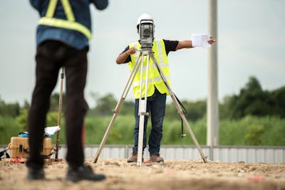
- Total Stations: A total station is an electronic/optical instrument used in modern surveying and building construction. It integrates an electronic transit theodolite with an electronic distance meter (EDM) to read slope distances from the instrument to a particular point. Total stations are invaluable for their precision in measuring angles and distances. When coupled with software applications, data collected from total stations can produce 3D models of the surveyed area almost instantaneously.
- Drones: Drones have revolutionised topographic surveying by providing a means to rapidly collect data and create maps of large or difficult-to-access areas. They are equipped with cameras and sensors to capture high-resolution images and generate photogrammetric maps and 3D terrain models. Drones enhance the efficiency of the survey process, reduce human error, and ensure safety by accessing hard-to-reach locations without the need for physical traversal.
Applications of Land Surveying
Land surveyors play a vital role in ensuring that construction projects are feasible, legally compliant, and optimally designed. Land surveying serves multiple functions throughout the phases of construction and development, each critical to the project's success:
- Site Planning: Surveying is the first step in the construction process. It involves investigating and mapping a site's topography and existing conditions. This provides essential data that helps architects and engineers design buildings and infrastructures that are appropriately integrated with the landscape.
- Legal Compliance: Accurate land surveys are crucial for defining property boundaries and ensuring compliance with zoning laws and building codes. They help prevent legal disputes by providing definitive proof of property lines and land use entitlements.
- Infrastructure Development: Land surveying informs infrastructure development by mapping out where structures like roads, bridges, and utilities should be placed. It ensures that these elements are constructed in the optimal locations, considering the natural terrain, existing infrastructures, and legal restrictions.
Understanding Land Survey Reports and Their Importance
Understanding and utilising land survey reports is indispensable for anyone involved in property development, management, or litigation, providing a clear legal framework for making informed decisions. Land survey reports are critical documents that offer detailed insights into a property's characteristics:
- Property Transactions: These reports are crucial during the sale or acquisition of property, providing buyers or investors with precise boundary lines and identifying any potential issues, such as easements or encroachments, that could affect the property’s use or value.
- Construction Projects: For construction planning, survey reports offer essential details about the site's topography, boundary locations, and existing structures or utilities. This information is necessary for designing a project that maximises the use of space while conforming to legal and environmental guidelines.
- Legal Disputes: In disputes over property boundaries or land use rights, a land survey report provides a legal basis for resolution. It is an authoritative reference that can be upheld in court if necessary.
Other Surveying Experts Available for Hire on iseekplant
At iseekplant, we understand that surveying needs vary widely depending on the project's scope and nature. That's why we offer access to a diverse array of surveying experts to cater to all your surveying needs. Whether you require detailed topographical data, need to resolve boundary disputes, or are planning large-scale construction projects, our platform connects you with experienced professionals across various surveying disciplines.
With hundreds of different surveyors for hire, iseekplant ensures you find the precise expertise required for any surveying challenge you might face. Here are the other surveying experts on our network of service providers and suppliers:
| Service | Average Rates | Application |
|---|---|---|
| Aerial Surveyors | $1,800 - $2,200 per day | Used for large-scale topographic mapping and environmental monitoring. |
| Building Surveyors | $120 - $150 per hour | Focus on construction projects, ensuring compliance with building codes and regulations. |
| Cadastral Surveyors | $150 - $180 per hour | Specialise in land division, defining property boundaries and rights. |
| Engineering Surveyors | $130 - $160 per hour | Work on civil engineering projects to ensure structures are built in the correct locations and to the right dimensions. |
| Mining Surveyors | $1,500 - $1,800 per day | Essential for mining operations, focusing on mine mapping and volume calculations. |
| General Surveyors | $100 - $130 per hour | Provide a range of surveying services including land and property surveys. |
Find Expert Land Surveyors with iseekplant!
Connect with highly skilled land surveyors across Australia today through iseekplant. We make it simple to get multiple quotes from top-rated professionals, ensuring you find the best fit for your project’s specific requirements. Start your project on the right foot with accurate data and expert insights. Email us at projects@iseekplant.com.au for any queries, or ring us at 1300 691 912. To get rolling, just tap on 'Get a Quote'!
Become a supplier
How It Works
Land Surveying FAQs
Here are some tips & frequently asked questions on how to find the right land surveyor for your job.
What do we have to offer?
Want to Know More?

Surveyor Cost Guide 2022- Get a free quote | iseekplant
In another era, today's surveyors may have been cartographers or what th...

Types of Surveyors & Costs 2022- Find a surveyor | iseekplant
Have you ever wondered how large structures or long distances are measur...