Applied Scientific Services & Technology Pty Ltd (ASST)
About
ABOUT US
Applied Scientific Services & Technology (ASST) provides cutting edge geoscientific solutions. Our approach uses advanced data acquisition, data processing and interpretation strategies which are at the forefront of industry technology.
We are cognizant of our clients’ project needs and offer a range of innovative, time-saving services that are tailored to project and client requirements.
GEOSCIENTIFIC SERVICE
WITH A DIFFERENCE
Our differentiator is fit for purpose, tailor made solutions combined with candid advice and completion with exceptional service integrity and business confidence.
From inception in 2009, Applied Scientific Services and Technology (ASST) has brought a wide variety of geoscientific expertise, unencumbered by the confines of traditional service providers.
We have built a reputation comprising of experience, quality and reliability backed by an unwavering commitment to integrity and fair practice. Our values are what have ensured us repeat business and continues to earn and retain the trust of our clients.
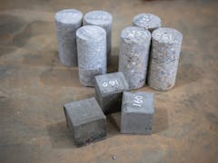
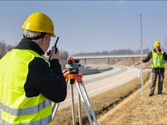
Our services cover every stage in the project life-cycle, ranging from, but not limited to: broad-scale reconnaissance surveys for pipeline routing, rail ballast investigations, soil characterization for a new processing plant, green-fields exploration for commodities or high-resolution investigations for site selection and de-risking.
EOSCIENTIFIC SERVICES
Applied Scientific Services & Technology prides itself on providing timely and cost-effective geoscientific services with a promise to deliver excellence! We strive for service quality that will instil absolute client confidence.
OVERVIEW OF OUR GEOSCIENTIFIC SERVICES
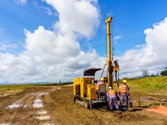
Applied Scientific Services & Technology consistently provides solutions to our clients’ problems using the most advanced acquisition, processing and interpretation strategies available. We are aware of the time critical nature of our clients’ projects and offer a range of innovative, time saving services that are tailored to the individual needs of the client at every stage in their project life-cycle – whether it be from broad scale reconnaissance surveys for pipeline routing or green-fields exploration for commodities, right down to detailed, high-resolution 3D seismic tomographic imaging of sites for foundation design, ground penetrating radar for cavity detection in urban sub-developments or marine geophysics for well platform site selection and de-risking.
A suite of leading edge, fully maintained geophysical instrumentation along with highly experienced field personnel, domain expert geophysicists, coupled with quality management and OH&S and environmental management systems mean that ASST can be relied upon to deliver the answers you need on time every time.
CONSULTING SERVICES
ASST provides specialised consulting services across the full spectrum of geoscience.
Ownership of data alone is of little use if it is not known where it is, what it is, its provenance and quality, accuracy and precision, both spatially and in observation. We can help you to collate your digital and analog data, reports and other observations. This data will then be reconciled, digitised where required, and arranged according to industry best practice. Spatially located observations, whether vector, raster, or other ascii or binary formats, will be cross-checked, metadata attached and converted into the appropriate coordinate system. Analog reports can be scanned and indexed. Relevant data from reports can be integrated the metadata for physical observations.
ASST will work to integrate data into client’s existing data management systems. Contact us to discuss how we can meet your expectations and project needs.
Services
Interested in Applied Scientific Services & Technology Pty Ltd (ASST)?
Is this your business?
Verify your listing to gain access to leads, update your profile and add more services and machines.
Verify NowMachines & Services
Services (4)
Locations
- 10 O'Connor Way, Wangara WA 6065, Australia


