GPR Imaging Solutions Pty Ltd
About
Welcome to GPR Imaging Solutions Pty Ltd
GPR Imaging Solutions is the premier ground penetrating radar company with offices in Melbourne and Tauranga operating Australia and New Zealand wide.
We specialise in pavements and bridge deck condition assessments using ground penetrating radar and infrared cameras. Our clients include government roading agencies, airports, ports, civil contractors, civil engineering consultants and utility companies.
We provide advice and specialist services to government agencies and large companies (see our clients below). If you have a challenging project and need specialist advice, please contact us for a free no obligation quote.
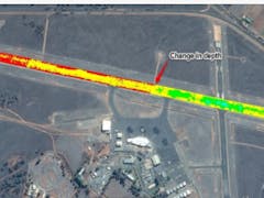
Partly due to our innovative work at Mildura airport, in 2015 GPR Imaging Solutions was successful in securing a 2 year contract to be on a panel for the Australian Government, Department of Infrastructure and Regional Development. This has been extended for a further 1 year.
We have undertaken a number of Australian firsts including introducing high speed GPR to the Australian market, locating moisture in pavements and using GPR for asset management of airport runways. The benefits of our system include:
Data can be picked up safely at highway speeds of 110km/h.
No traffic control is required.
No invasive coring to calibrate
Calculates pavement layer depths to a high accuracy
Identifies moisture ingress
Detects spalling and concrete degradation
Locates cavities / tomos / voids
Ground penetrating radar New Zealand and Australian services offered by GPR Imaging Solutions includes pavement analysis, bridge deck condition assessment, airport runways, aprons & taxiways, utility mapping, geotechnical and infrared surveys:
Pavements – Roads, Airport Runways and Ports
Pavement Layer Depths and Makeup
Moisture Ingress Locations – Pavement and Subgrade Levels
Detecting Cavities / Voids / Tomos
Comparing Pavement Structure e.g. Between Lanes and Shoulders
Locating Pavement Joints / Boundaries
Detecting Settlement
Segregation in Asphalt or Aggregate Layers
Asphalt Delamination
Asphalt Density
Pavement Inventory for Records
FWD Integration
Pipe Detection
Bridge Deck Condition Assessment
Asphalt Overlay Depth – Profiling
Degradation / Deterioration of Concrete
Reinforcing Steel Corrosion
Concrete Cover
Infrared Surveys
Geological & Utilities
Mapping Geological Features e.g. Basalt Rock Layers
Ground Water Table Level
Plume Contamination
Utilities Mapping
Results / Outputs
ASCII Files Compatible with other Software and Databases
Excel Spreadsheets
Geospatial Mapping
Reports
Services
- Ground Penetrating Radar
Interested in GPR Imaging Solutions Pty Ltd?
Is this your business?
Verify your listing to gain access to leads, update your profile and add more services and machines.
Verify NowMachines & Services
Services (1)
Locations
- 60 Relowe Crescent, Mont Albert North VIC 3129, Australia


