Wayne Mitchell Surveying
About
WELCOME
Wayne Mitchell Surveying has been providing surveying and mapping services to Victorian industry since 1995.
As licensed land surveyors based in Melbourne we provide surveying services throughout Victoria. Our expertise, field equipment, total station, GPS and computer facilities have kept us at the forefront of surveying practices in Victoria.
COMPANY PROFILE
Wayne Mitchell Surveying (WMS) has been in operation in Victoria since 1995, and is very well established within the Victorian Surveying and Mapping Industry. Wayne Mitchell heads the Company and is a Licensed Surveyor with 30 years of surveying knowledge and experience. Wayne prides himself on the accuracy of his profession and is fastidious about the quality of service provided.
Our administration staff and field parties are equipped with the latest measuring equipment and computer programs, this in turn provides substantial time and cost savings to our clients. Our up to date knowledge and ongoing professional development allows us to provide a variety of services to our clients with confidence.
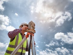
We offer a wealth of experience in all facets of surveying involved with pipelines, contour and feature surveys, construction control, title and subdivision work. We use the latest fully robotic Total Station (one man) technology and have access to all GPS, CAD, and computer technology. This facilitates us providing the client with the best high quality service available from the ground up - surveying to plan production.
Our experience, expertise, field equipment, total stations, GPS and computer facilities are equal to the best practices in Victoria. It is our active intention to provide quality surveying to our clients and strive to maintain a high level of professionalism by continuing to identify and implement realistic cost effective solutions within the Surveying Industry.
We have a reputation for high quality surveying and strive to provide a high level of client service whilst implementing realistic and cost effective surveying solutions.
ASSET RECORDING
Since 1995 Wayne Mitchell Surveying has been assessing and recording assets for clients across a broad range of industry. We use state of the art equipment and processes to deliver highly accurate asset records directly to our clients.
construction asset recordingOur asset recording and mapping services include most forms of infrastructure, power poles, boundaries, pipelines, dams, bridges manhole covers etc. We record and map any asset whose location needs to be geographically referenced and recorded digitally.
Captured data can be uploaded directly to client databases and can then be used in a range of end-use applications including GIS, database generation, 3D modelling software or a range of digital mapping packages.
asset recordingWe have the expertise, technology and ability to deliver large-scale data capture projects to specification, on budget and on schedule.
ASSET RECORDING
Western Water - Arnolds Creek Estate, Melton
Locations and recording of water and sewer reticulation assets for in excess of 900 lots.
AS CONSTRUCTED SURVEYS
Melton Sewerage OutfallMonitoring of construction accuracy over 6 kms of 1350mm diameter sewerage outfall at grades of 1:1450 (in progress).
Goulburn River to Broadford Pipeline24 kms of pipeline survey (in progress).
Grantville PipelineAs constructed survey of 16.3 kms of water supply pipelines from Coronet Bay Bore to Candowie Reservoir.
Melton Wastewater Treatment PlantMonitoring of accuracy of plant upgrade (in progress).
Yarra Valley Water - PRV SitesAs constructed surveys and documentation of 25 installations including preparation of drawings.
Services
Interested in Wayne Mitchell Surveying?
Is this your business?
Verify your listing to gain access to leads, update your profile and add more services and machines.
Verify NowMachines & Services
Services (4)
Locations
- 5 Trade Place, Vermont Victoria 3133, Australia


